Hello

Blog Search


Jul
13
0 comments
Category:

IMG_6189-2.jpg 

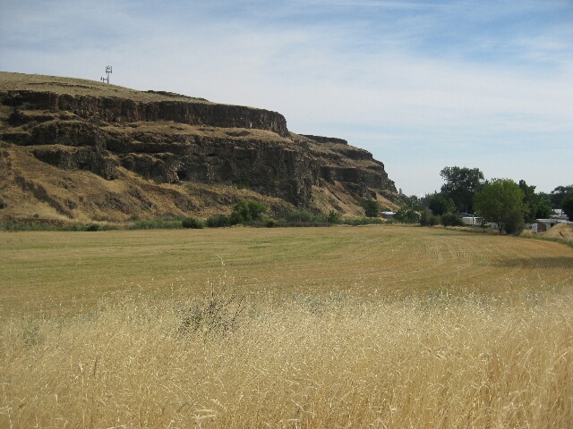
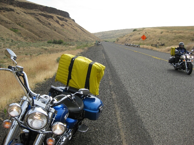
After collecting a tourist guide from the hotel we decided to strike out off the track to check out Pilot Rock. We were told it was impressive and a nice ride. It was a pleasant ride through open grassy hills with lots of sweeping corners and no trees to speak of so visibility clear for many corners in advance at times but instead of a Devils Tower type arrangement we expected to see, this was in fact Pilot Rock which a very forgetable town was named after.

IMG_6188-2.jpg

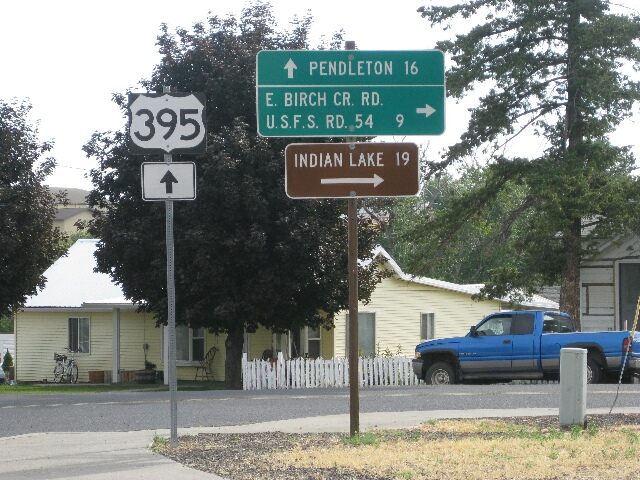
Not all for nothing, Norm spotted this sign which reminded him of the 'Indian Lake' song.

 IMG_6190-2.jpg

However.......the ride from here to Heppner and back into Lexington was an absolute blast! We climbed up and down mountains with magnificent sweeping views down valleys and threaded between great valleys with rugged rocky outcrops and found one switch-back after another. This 'No center stripe' sign intrigued me, surely the people who did paint the sign could have removed this and many others saying the same thing and then we came upon the truck doing the painting.Ha ha.

IMG_0897-2.jpg 

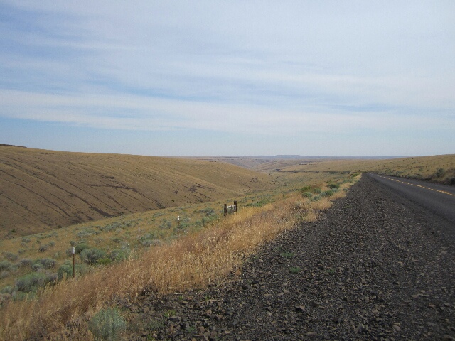
On top of the world and looking back down the valley on the way to Heppner.

 IMG_0896-2.jpg

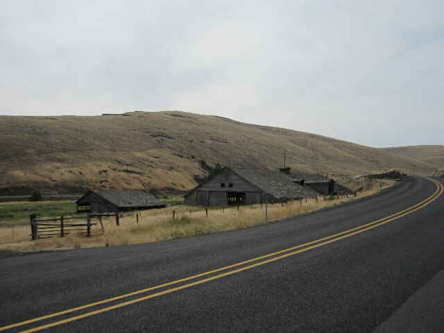
We came across a collection of apparently abandoned timber barns and outbuildings. The big one literally built into the side of the hill. Clearly this is not in tornado alley or they would have disintegrated long ago.

 IMG_0898-2.jpg

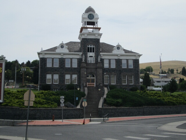
The Heppner Court House. We thought it was abandoned with the barricade across the door but the cupola and clock has only recently been replaced after being repaired and they are still making sure it is secure before it is removed.

 IMG_0901-2.jpg

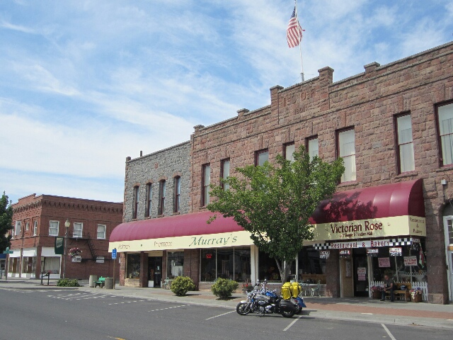
Main Street. It appeared to have been a grand town which has it's challenges as a lot of rural and regional towns here and at home have.

 IMG_0902-2.jpg

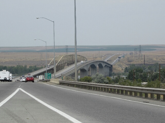
We headed back though Echo and Hermiston to cross the mighty Columbia River having been told it is a nicer ride on the Washington State side of the river. These are the bridges which cross the river at Umatilla and once we we crossed we found the temperature dropped when we were close to the water and the whitecaps on the river confirmed the wind was blowing across the water from the south which I guess explained that.

 IMG_0906-2.jpg

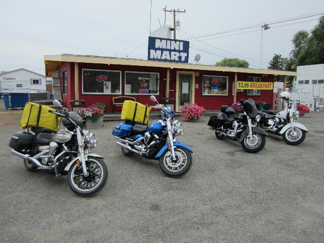
The ride was indeed spectacular with steep grassy hills with rugged rocky outcrops and cliff faces and the massive river winding it's way down on our left with an occasional vineyard and orchard as well. When we were in Portland in 1998 we were told the Columbia River discharges more water into the sea each year than the sum total of all rivers in Australia. Don't know if that is right but even if it is only close it's awesome. It is the border between the States of Oregon and Washington and makes the 'Mighty Murray' look a bit of a trickle between New South Wales and Victoria! We stopped at a quirky collection of buildings, bits and pieces and 'shame file yards' in Roosevelt and had a delicious burger and plank fries (huge). These were the 2 bikes there when we got there and ours.

IMG_0908-2.jpg 

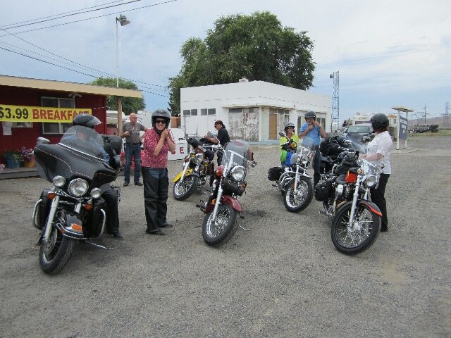
These belonged to a group of friends heading east for 10 days on their first day out. Reminded us of the Tassie Tigers from the Traralgon Easyriders who went to Tasmania with us. Missing you guys and enjoying so many rides you would all love!

By the way, we had some rain spots and strong winds complete with black skies and lightening in the distance as we headed for The Dalles this afternoon and could see rain sweeping toward Mount Hood standing in all it's snow covered glory. It is snow covered all year but was shrouded in fog the whole time we were in Portland last time we were here so couldn't see it from a distance, only up close when we drove up to the Lodge where 'The Shining' was filmed. We enjoyed the weather cooling down soon after we got in this afternoon and heard on the TV weather a short time ago that it had cooled down to 102 F! 

It should also be said that the farther north we travelled the more we were grateful for the cloud / smoke cover. There have bee many wildfires in Washington State over the last week so reduced the sun penetration somewhat.

Even though we weren't right on the official 'Oregon Trail' we were pleased to see things honouring the emigration and the settling of the land we passed through with signs where we crossed trails as well as an Oregon Trail Library in Heppner and a Memorial with a wagon and a windmill in Lexington. Looked good.

Bits and Bobs:

 IMG_0912-2.jpg

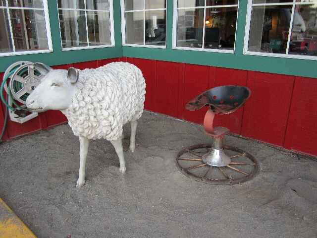
A quirky stool (and company to chew the fat with) in The Dalles at our Inn.

Last Night's Accommodation:

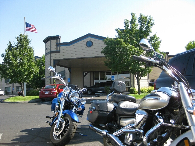
Oxford Suites Pendleton, 2400 SW Court Place, Pendleton, OR 97801

Good decor and well maintained building and surroundings and an elevator tonight. Yay. Comfortable bed. Good sized room and good amenities. AC, swimming pool, gym, included parking, wifi, hot breakfast. On the outskirts of town so a bit of a hike to dinner so we ordered a pizza. Better than going back out in the heat so worked well.

IMG_6187-2.jpg


View Comments
Tags

Jul
12
0 comments
Category:

We headed off for a short day's travel today which was just as well as the temperature was supposed to be very high 90's and ended up reaching 103 F. Felt like we were in an oven by the time we got in.

 IMG_6181-2.jpg

Our first stop not far up the mountain was at the Hilgard Junction State Park not far out of La Grande which was on a spot the emigrants travelled through. This must have felt wonderful for them to be in a pine forrest with grass underneath for the livestock. 

 IMG_0852-2.jpg

It felt good to be amongst the tall trees but it wasn't without it's trials for the emigrants, see the board we saw on site.

IMG_0856-2.jpg 

We peeled off the Interstate again to find the 'Deadman Pass' and we had also previousy read that because of the height and weight of the wagons with the centre of gravity so high that the wagons used to go straight up and down hills so they wouldn't tip over, hence the combination in the previous board rather than tackle hills on an angle less steep. The hills they encountered to descend the Blue Mountains were massive so we can well understand the name given to this area. This is a view from a lookout before we began to descend.

 IMG_6184-2.jpg

A view from Emigrant Road, also called Poverty Flat Road to Interstate 84.

 IMG_0865-2.jpg

And continuing down again and you can see the Interstate as it descends into Pendleton, also a good looking biker on his way down the Pass. Once we were down on the flat we were literally surrounded by miles and miles of golden wheat fields ready for harvest for as far as we could see all around us up until the surrounding mountains which seemed to totally surround us.

 IMG_0874-2.jpg

We enjoyed the Museum in Pendleton, they had a good coverage of the Oregon Trail emigrants but aso the growth and change in the Pendeleton area itself. This is a shot of a log cabin (and barn) moved from out of town. We were blown away to hear that the cabin had been lived in by the owner and his family until 1960, and then used for another 30 years as stockmans quarters. The part we enjoyed the most was of the changes emigration brought to the area with increasing agriculture and use of water with irrigation which led to the demise of salmon populations with the destruction of the flow for salmon to return to spawn. Local efforts have now overcome this providing salmon ladders where there are dams and allocating more water to maintain flows and the salmon are returnng and increasing. Well done!

IMG_0870-2.jpg 

And finally, this is a Railway Express Agency exhibit but we loved the timber seat at the front. Beautifully built and the shape was magnificent.

Two 'Must Sees' the hotel told us about which sounded good were the Underground and the Woolen Mills. Unfortunately the Underground which was litrally underground was where Chinese immigrants operated providing food and entertainment for earlier settlers. Sounded good to me, would have been cooler down there than above ground today but all tours were booked today and none tomorrow. Then we went to the Woolen Mills but found they don't have tours on the weekend. Ah well, we checked out the shop and bought some belts (see below). The Mill has been operating since 1910 and continues today. They use mainly American Indian prints which are beautifully colourful and as well have lots of beautiful cotton towells and rugs and lots of clothing, homewares and all sorts of decorator items as well as an outlet shop.They have branched out well to stay relevant. Good to see. Obviously have their patterns patented.

 IMG_0886-2.jpg

Another thing Pendleton is famous for is their Rodo, which was established the same year as the Woolen Mill so the area must have been doing well. This is in front of the Rodeo Centre.

Bits and Bobs:

 IMG_0871-2.jpg

A shot for my haidresser Jenny S, found this in the Pendleton Museum. Electric hair rollers from the past. Imagine carrying all that around in your car!

 IMG_0875-2.jpg

A quirky stool we found in a little local display where we watched a video of some awesome saddle work by an old guy who was recognised by the Smithsonian Institute as an Artisan. Can't take a shot of the saddles but can of the stool.

IMG_0889-2.jpg 

And a souvenir purchase for us both from the Pendleton Woolen Mill.

Last Night's Accommodation:

Best Western Plus Rama Inn & Suites, 1711 21st Street, La Grande OR

Good decor and reasonably well maintained building and surroundings. Comfortable bed. Good sized room and good amenities. AC, swimming pool, gym, included parking, wifi, hot breakfast. Walked a short distance for dinner. Staff very helpful. On the outskirts of town but handy to the interstate so suited us. No elevator so a lug up the stairs with cases.

IMG_6179-2.jpg


View Comments
Tags

Jul
11
0 comments
Category:

The thumbnail shot is of a replica of the Old Fort Boise which looked okay from the outside but since it didn't open until 3pm and we were there at 10.30 am we didn't see inside.

IMG_0806-2.jpg 

In our efforts to stay off the Interstate we got a bit off the track and found the little town of Vale where we had a coffee. This is a shot along one of their main streets and you can see part of a mural to the right tracking the development of the area. The one you cannot see to the right is Chinese people on a gold site called El-Dorado Ditch, the next cattle men, the next more intensive farming / agriculture and the last sheep with their shepherd. Along the bottom are heaps of people in multiple national dress costumes so obviously a tribute to those who settled here from many other countries. Looked good. 

From here we headed back on track and checked out the Farewell Bend State Park where trails separated away from the Snake River and looking at the steep dry hills still looked like hard work to me. The only advantage I could see was a bit easier access to water and the sagebrush wasn't as prolific or as tall, which was apparently shoulder high when the emigrants made their way west. 

 IMG_0823-2.jpg

When we finally got to Baker City we discovered why some months ago when we tried to book a bed here we couldn't get one. The 'Hell's Canyon Motorcycle Rally 2014' was in full swing. This is an annual event. Here is a shot along one of the main blocks in town, motorcycle parking only. 

 IMG_6173-2.jpg

And another.

 IMG_0826-2.jpg

One thing they had there was a 'bike wash' named 'hog wash' since nearly all the bikes were Harley Davidsons and these were some of the girls I thought were doing the washing as they were at the site when we spotted it, turns out they were just walking through and turning lots of heads. A bit cheeky you might say. Lots of bike dealers there and some awesome prices offered. 

IMG_0833-2.jpg 

We checked out the Museum in Baker City which had a number of Oregon Trail artefacts and then headed for the National Historic Oregon Trail Interpretive Centre just out of town at Flagstaff Hill. It was done really well with life size diarama's and lots of exhibits. This was a view from the site and the sandy trails are wagon ruts and there were many all around the area and clearly visible from up on the hill. This area is where the emigrants got their first site of the Blue Mountains in the distance letting them know that their long journey would soon end in the Willamette Valley.

Bits and Bobs:

IMG_0828-2.jpg 

By the time we got to Baker City we were both hot and grumpy and got some lunch as a priority. After we had lunch and were walking along the street looking at the bikes Norm said "Ah so that's where it landed", I asked him what he was talking about and he pointed to the above. Ha ha.

 IMG_6175-2.jpg

One for the Shame File (at most a third of what was there) on the Hell's Canyon Road Flagstaff Hill as we headed for the Interpretive Centre.

 IMG_0849-2.jpg

We saw a lot of bull at the Interpretive Centre.

Last Night's Accommodation:

Oxford Suites Boise, 1426 S Entertainment Avenue, Boise ID 83709

Very nice decor and well maintained building and surroundings. Comfortable bed. Good sized room and good amenities. Separate bath and shower. AC, included parking, wifi, nibbles and drinks in the evening, full hot breakfast. Walked next door for dinner, one of many choices close by. Staff very helpful. On the outskirts of town but handy to interstate so suited us. Slightly more expensive than the last couple of nights but still good value.

IMG_6171-2.jpg


View Comments
Tags

Jul
10
0 comments
Category:

The thumbnail shot is of the 3 Island Crossing State Park centre near Glenns Ferry. This is on the site of some wagon ruts and between the 2 Island Crossing site and the 3 Island Crossing sites where emigrants could cross to the north side of the Snake River. The Education Centre and display were great and was a respectful collaboration between the EuroAmericans and Native Indians and was very balanced. I like this more than any others we have seen and we have liked them all. The others were also respectful but there was obviously more direct input from the Native Indians here and it worked really well.

 IMG_0763-2.jpg

A shot in Glenns Ferry named after the man who in 1869 established a ferry to float emigrant wagons across the Snake River, and other wagons, goods and people across. This later became a hub for rail transport and still has massive freight trains moving through. We parked up to get a coffee and a bite to eat and I wanted to get a shot from across the rail tracks and had to wait for a train to pass. After I thought it should have been done I started counting and got to 41 carriages before another engine in the mix passed me and another 61 carriges passed after that so I'd be surprised if it was less then 200 carraiges overall. A combinatin of livestock carriages (all empty) timber board products, oil tankers, flat bed carriages, containers, open carriages we have been used to seeing coal in, and many other carriages which were anonymous. Awesome! All that aside this is a shot of a street in Glenns Ferry. It reminded me a lot of many of the little towns in the wheat / sheep belt on the way to Adelaide. Baking hot, sandy soil and not a lot of activity. The temperature has been in the high 90's for a few days so we headed off early today to try and beat the heat.

 IMG_0767-2.jpg

A shot of the 3 Island Crossing site which is now a good example of what modern access to water in a desert can produce. Emigrants who traded with Native Indians to guide them and help them through the crossings went pretty well with fewer incidents as they knew the waters, currents and where the holes were as this was a salmon fishing area for them. In spite of the danger of the crossing (also necessitating another one back to the south of the river in Boise) meant the emigrants had good access to water, more abundant feed for animals and easier passage. Must have been a relief to get acoss after all the dessert and rugged canyons they had traversed.

 Three_Island_Crossing_of_the_Snake_River_Idaho.jpg

This is a shot of the William Henry Jackson painting of the 3 Island Crossing which is on the front of the booklet we have been following through Idaho.

 IMG_0785-2.jpg

 We climbed up off the Interstate to see the Bonneville Point which gave a good overlook of Boise in the distance but as we had seen the hills in the distance today under a pink to purple haze beause of wildfires further east we didnt see enough to look very impressive in a photo but we had called into a Yamaha Dealer in Mountain Home to see if it would be possible to get a replacement visor for Norm's helmet but no it is availabla only in Australia BUT we heard of a great spot to ride to for an experince of the Wild West. This shot is of the dam wall of the Boise Dam as we headed for the East Lake Forrest Drive. It was a great spot for the locals to relax in a beach like environment and even if the breeze was in short supply (hard to imagine with all the wind we have experienced) there would be a hint of cooler air with the fountain effect in the water.......I'm guessing here though the air has certainly been cooler to ride through when irrigation areas are actually irrigating.

IMG_6168-2.jpg 

A shot of the Mores Crreek bridge over part of the Arrowhead Dam. We were well into the ride to Idaho City here which was an awesome ride of one sweeping corner after another with steep cliff faces and precipitous hills covered in Ponderosa Pines and galloping streams beside the road. A delight!

 IMG_6169-2.jpg

A house ??? I think in Idaho City. Not a shop anyway but all kinds of quirky and I doubt it complies with ANY building codes.

 IMG_0796-2.jpg

A view across the street in Idaho City from where we had a bite and a delicious huckleberry icecream. Yum! We were reading about the cafe owners and the wife's grandfather (part owner of a saloon in the town) died in a gun fight in 1936! Blew us away! Pardon the pun. In a gunfight...not shot, even said who shot him, I kid you not.

 IMG_0798-2.jpg

And along the veranda in front of where we were parked. There is a wild west shootout on weekends. Eeh hah!

Bits and Bobs:

 IMG_0799-2.jpg

I wanted a shot of the bikes in front of a ranch entry and runnng out of opportuniies......as well as ones I would be happy to be in front of. Liked the Ponderosa Pines here (on the Poderosa Pine Senic Byway to Omaha City) and figured I might not get any more chanes to get a shot of snow capped mountains through the gate. Every one I've seen so far I either couldn't stop at or the sun was shining in the wrong direction......and I tell Norm he's a perfectionist!

Last Night's Accommodation:

Best Western Plus Twin Falls Hotel, 1377 Blue Lakes Blvd. Twin Falls ID 83301

Well maintained building and surroundings. Comfortable bed. Good sized room and good amenities. AC, included parking, wifi, buffet breakfast and 24 hr gym and pool. Walked next door for dinner. Staff helpful. Sounds the same as the last one doesn't it, the quirky thing is that the hotel is an exact replica in style inside as the last one, even down to the prints on the walls!  Forgot to take a photo so here is one from the website.

BW_-_Twin_Falls_-_ID-310_D.jpeg


View Comments
Tags

Jul
09
0 comments
Category:

The thumbnail shot is another one of the massive Snake River, this is downstream from Twin Falls.

We shared some of the frustrations of the emigrants today. Around much of this area they could see and hear the water but couldn't access it for hostile canyons barring access or sheer cliff faces which couldn't be negotiated. We set out looking for the Kanaka Rapids but discovered the road to access them is now part of a private community but we later learn't from a local that as a result of a dam they are now covered and cannot be accessed anyway. We also found the same outcome for the Bell Rapids. DOH!

IMG_6150-2.jpg

What we did see were some of the cataracts making up what is known as the Thousand Springs near Hagerman. In this area emigrants traded with Indians to get salmon,

IMG_0741-2.jpg

We set off then to find the Malad Gorge which was yet another deep canyon split through the black volcanic rock of the dessert floor. We were amazed at how much of the cliff walls were crumbling and leaning out into the gorge. The gorge is 140 foot wide and 250 foot deep.

IMG_6160-2.jpg

An awesome find for the day was a recommendation of a local which was the 'Balanced Rock' and here it is.

IMG_0743-2.jpg

And this is part of the canyon we travelled through to get to it.

Again, once I get the You Tube thing sorted we have a video of Norm riding through the canyon.

IMG_0749-2.jpg

Back closer to Twin Falls is the Perrine Bridge which spans the Snake River, which is 500 foot above the river and apparently it is common to have people bungee jumping from under the bridge but not today. The coloured specs in the water are people in canoes.

IMG_0748-2.jpg

And a view back up river from the bridge.

Bits and Bobs:

IMG_0736-2.jpg

A cute fire truck sign from Hagerman.

IMG_6147-2.jpg

One for the shame file - River Road Twin Falls, saw many others in the canyons also.

IMG_6156-2.jpg


A creative sculpture on the side of the street in Buhl.


View Comments
Tags

Jul
08
1 comments
Category:

The thumbnail is a shot of the magnificent Snake River not far out of Pocatello. The emigrants had followed this river as they had the Platte River further east.

Oh and in case anyone was wondering, we came across 2 more Subway stores on our way out of Pocatello. 

I was intrigued that the mountains around Pocatello looked like they were vertically gathered up with valleys folding over one another and leading down to the high altitude desert plains. The town lies in the foothills right on the lower rims of the mountains and was probably a relief to emigrants glad to be through the mountains but they were soon to find a whole lot more nothingness reminiscent of the country they had already traversed. So today we headed out into flat somewhat featureless plains covered in saltbsh, some cottowood trees evident along waterways and then just disppearing into the hills and that's what the emigrants would have seen but today we had the added element of irrigation which brings the land to life. Quite a contrast.

IMG_0697-2.jpg 

We decided early in the day to do the tourist rather than the Oregon Trail purist thing and headed for the American Falls which are now covered by a hydro dam so only a few of the cascades are visible at the spillway. There were a lot of pelicans here doing some opportunistic feeding and a lot of smaller birds no doubt feeding on the glut of tiny flies which were in plague proportion!

 IMG_0699-2.jpg

From there we had the choice of Massacre Rocks or Register Rock. I figured for deaths on the trail overall those from massacres were not high and I didn't need to see a reminder of that so we headed for Register Rock to see where at the end of the day after eating and feeding stock emigrants recorded their passing by inscribing their names on the rock and here is one.

 IMG_0702-2.jpg

From here we headed off on what was the Californian Trail to see the 'City of Rock' which was quite a spectacle. This is a shot in Albion on our way.

 IMG_0705-2.jpg

This is the entrance to the park and the city is visible in the distance. Note the gravel. Before today on this trip we had already ridden on more gravel than I had previously ridden on and did nearly as much again today.

 IMG_0707-2.jpg

And a shot of Camp Rock, again with names inscribd on it.

IMG_0711-2.jpg 

And a view back down to the flat lands we had come from.

When I can load video onto You Tube I will add a link here of a short vieo (perhaps 2) Norm took riding through the City of Rocks. 

 IMG_0714-2.jpg

We saw a combination of large commercial ranches and holdings and small farming lots today with equally smaller machinery and infrastructure. We had lunch in Oakley with many substantial buildings (this is one) but struggling.

 IMG_0716-2.jpg

We called into Shoshone Falls known as the Niagra of the West, east of Twin Falls which now powers a Hydro Power Station and is still very impressive and while this wasn't on the trail of those travelling with the wagons, they apparently often trekked to see them to find the source of the roaring water. The contrast of the black volcanic rock to the sandy high prairie desert land was stunning. This was a look over the spillway.

Needless to say there was again lots of wind and many wind farms in out travels today not to mention temperatures in the high 90's. We were grateful of a little cloud cover this afternoon and also grateful when we finally got to the hotel. Felt like big day. 

Bits and Bobs:

 IMG_6127-2.jpg

The road we followed to see the City of Rocks and yes the tarmac was about to run out and deteriorate greatly from the surface in view.

IMG_6142-2.jpg 

Yep gravel, gravel and more gravel and this was some of the best of it.

Last Night's Accommodation:

Ameri Tel Inn Pocatello, 1440 Bench Road, Pocatello, ID 83201y

Well maintained building and surroundings. Comfortable bed. Good sized room and good amenities. AC, included parking, wifi, buffet breakfast and 24 hr gym and pool. Walked next door for dinner. Staff helpful. Only marginally more expensive than last nights stay. 

IMG_0690-2.jpg


View Comments
Tags

Jul
07
0 comments
Category:

 IMG_0668-2.jpg


We enjoyed our time in Jackson Hole which reminded us somewhat of Queenstown in New Zealand with the timber buildings and timber walkways and lots of top end shopping options. This is also a snow resort as well as supplying a huge outlying ranch area.

Roadcraft lessons 101 - No matter how spectacular the scenery ALWAYS keep your minds eye on the road ahead, traffic and any other hazards:

1. Yesteray we experienced a car overtaking a car coming towards us in our lane and despite headlights and driving lights on our bikes and the car he was overtaking blasting his horn he kept right on coming. We were extremely fortunate there was actually tarmac to the right of the road edge line as there often hasn't been. Too shocked to do anything other than get the hell out of the way! Sorry to reeport that the same thing happened again with less notice today, again we had room to get out of our lane but we both gave him the finger! Felt better about that.

 IMG_0673-2.jpg

2. When the sign on the side of the road says 'Watch for Falling Rocks' it means it. This was a shot from across the street from our hotel last night. It was above a large cutting on the main road. Ouch!

 IMG_6119-2.jpg

We travelled through a series of National Parks through the mountains and gradually headed back to the Oregon Trail. This was the highest we got to and looks down the valley we are about to head down. The sign is self explanatory and you can also see the high markers for snow which were in evidence through most of the day. For a comparison Mt Kosciusko is 7, 310m high (2, 228 ft) so we were 320 ft or 98 m higher today than that.l

And the one we had just climbed through.

 IMG_0684-2.jpg

We visited the National Oregon / California Trail Centre in Montpelier ID (Sculpture at the front) which was interesting and we enjoyed the tour.The last Wagons to go through Montpelier was 100 years ago this month so the rail must have been a bit slow in this area. We were surprised to hear that wagon groups were so large, apparently 60 minimum and maximum 100. Also the enticement of free land in Oregon applied to both men and women so a couple were granted 300 acres each. This was awesome for women and was an enticement to get women out there I guess as women couldn't own property anywhere else in the country at that time.

 IMG_6123-3.jpg

The ride got very hot through the afternoon so we didn't stop at Soda Springs which was a camp spot for those on the trail. It looked an inviting spot with a good body of water. We moved on to Lava Hot Springs which was like an oasis in a reasonably hostile environment and we stopped at a picnic spot for a break. Norm took advantage of that and walked down to the river where the locals were out in force floating down the river in rubber rings........and his wife having a nap. Is nothing sacred? There was apparently a spot after the cascades with bubbles rising so might have been a good spot for a warm bath for the emigrants.

 IMG_0688-2.jpg

A look back along the main street of Lava Hot Springs as we left.

Staying in Pocatello tonight, a huge place. As some indication, we passed 4 Subway stores. Ha ha.

Bits and Bobs:

 IMG_6124-2.jpg

Heading for Pocatello 'We saw a dead skunk in the middle of the road, saw a dead skunk in the middle of the road, saw a dead skunk in the middle of the road and it's stinkin to high heaven!'

Last Night's Accommodation:

The Virginian Lodge, 750 West Broadway, Jackson Hole, WY 83001

A budget and quirky spot but has A/C Yay. Complex spread out over 14 acres and includes 200 + rooms, Restaurant, Saloon and swimming pool. Comfortable room and if I had remembered to pack my bathers might have made use of the pool. Room only but wifi and parking included.

IMG_6115-2.jpg


View Comments
Tags

Jul
06
0 comments
Category:


IMG_0641-2.jpg 

Close to the last shot of Yellowstone, Mammoth Springs to be exact.... a look over the sulphur tiers, well a small, part actually. The volcanic activity here is nowhere near as offensive on the nose as we have experienced in New Zealand, perhaps because it seems to be water and steam here where there is lots of mud involved in NZ.

Yellowstone National Park, it would be easy to spend weeks here, a seemingly never ending series of mountains, canyons, galloping waterways, lush grasslands, towering pine forrests,prolific meadows and hillsides of summer wildflowers and awesome wildlife with a bit of volcanic activity thrown in for good measure. Next stop the Grand Tetons National Park and this is yet another different experience of high plains meadows intersected with waterways which are aptly named 'Gros Ventre Wilderness' which translated I think is 'Great Open Wilderness' and encircled by what looks like a crown of mountains which are the Grand Tetons.

 IMG_0653-2.jpg

Last one in Yellowstone, Lewis Falls.

IMG_0658-2.jpg

A view across Jackson Lake to the first of the mountains in the Grand Teton National Park.

 IMG_0664-2.jpg

A shot as we were nearing Moose Creek where we lunched at a Chuck Wagon of sorts.

IMG_6113-2.jpg

Here is a street shot of the Million Dollar Cowboy Bar in Jackson Hole which a friend had told us about and it is all kinds of quirky.

 IMG_0666-2.jpg

And this is one of the reasons why it is so quirky, yep the bar stools are all saddles, and the quirkiness continued in all ways Cowboy.

Bits and Bobs:

 IMG_0644-2.jpg

Okay, so I know the servo is in Mammoth Springs, but the irony of the sign and size of the total number of pumps was too good to pass up.


IMG_0659-2.jpg

After Norm saw me laying down in the stones to get a shot of the Grand Tetons with some wildflowers in the foreground, he figured there had to be an easier way to get a shot, and this is how he did it.... wasn't too bad either.

Last 2 nights accommodation:

Mammoth Hot Springs Hotel, 1 Grand Loop Road, Mammoth Hot Springs, WY

An ancient and historic building. Massive hallways. Large public spaces and helpful staff. Reasonable sized rooms given the age. No A/C so glad we were on the ground floor. Needed our window open and fan on to sleep. Had our own bathroom and glad we did. Room only, no wifi but available next door when the dining room is open (charges apply). Been a bit of a refurb but old stained chair and many stains on the room carpet. Bit sad really.

IMG_6073-3.jpg


View Comments
Tags

Jul
05
0 comments
Category:

 We have had a great day exploring the park and have seen heaps of bison and a number of elk. We even spotted a bear, grissly we think since we had just been reading that it is their habitat. He was big and ambling through a small thicket of lodge pole pine. A bit daunting to realize we are not the top of the food chain!

IMG_6072-4.jpg 

Yellowstone lawn mowers off duty.

 IMG_6070-4.jpg

And on duty.

 IMG_0564-2.jpg

Not far out this morning we found the first of the elk we saw for the day. They had a beautiful meadow to themselves.

IMG_0586-2.jpg 

Another flower I hadn't seen before and we had come past hillsides of them in the grissly territory which they feed on. This is the area which specifies camping in hard sided campers only......to preserve the fresh meat obviously.

 IMG_0595-2.jpg

A shot of the Lower Falls in the Grand Canyon of the Yellowsttone, and check out the great lump of snow still to thaw.

 IMG_0603-2.jpg

And some distance below the falls. We saw massive bodies of water in rivers and cascading down rocks and pouring over falls throughout the day.

 IMG_0622-2.jpg

The Old Faithful Geyser which is the worlds best known geyser. We arrived about 7 minutes before it blew and watched it with at least a couple of thousand other people. Don't know where they all came from.

 IMG_0624-2.jpg

MY Old Faithful Geyser AKA Normie John.

 IMG_6091-3.jpg

An interesting bit of engineering on the road heading back to our hotel. The roads have been exceptionaly good quality and the walks and overlooks maintained well


View Comments
Tags

Jul
04
0 comments
Category:

Yay the Federal Government has provided Internet Connection. All hail Federal Government.

The thumbnail is a shot of Uncle Sam at the Cody Independence Day Parade.

A first for us was to attend a real 4th of July Parade. There were 140 entries including several huge bands (120 the largest) and it was a great atmosphere. Cody (as in Buffalo Bill AKA William Cody) has the World champion Rodeo among other things running 90+ nights in the summer. Tonight was to be the largest with top prize in excess of $400,000.00 USD. A couple of shots of the parade which we really enjoyed follows.

 IMG_0437-2.jpg

The Wyoming Marines were here in force.

 IMG_0465-2.jpg

Miss Rodeo America, a shame the sun didn't show up the sparkles. Very impressive.

IMG_0482-2.jpg 

And finally the Wyatt Earp group. Sobering. We have read that often the 'lawmen' (rough and tough and often gun slingers) were invited to a town to be Sheriff and then fired after they cleaned the place out......I suspect some of our politicians think politics works the same way today.

IMG_0433-2.jpg

We were aware that the majority of exhibits in the parade were either community groups or groups within the community (trust me they are different) and a lot of focus on the Cowboy heritage. I've come to realise that as Australians we have 'The Outback' and the USA has 'The West'.  I've never before seen corn cooked on such a hge sale. This is Kettle Korn, Impressive!

 IMG_6061-2.jpg

Climbing into Yellowstone Park. One magnificent vista or huge sky everywhere we looked. (Not going to fess up to how many photos I took today!)

 IMG_6066-2.jpg

And a view from an overlook over part of Yellowstone Lake which is massive. Soon after this we rode through an area which had experienced rain shortly before and the fragrance of the forest was sublime.

 IMG_0529-2.jpg

And a shot of a Bison close to the road. Just after this he had a ball rolling in the dust as I saw a few doing. Perhaps they are trying to get rid of the last of their winter coats.

 IMG_0548-2.jpg

And some Falls on the way to our hotel. The volume and speed of this water was incredible as it galloped down through the canyon!

 IMG_0556-2.jpg

And finally, a lovely shot at the foot of the Canyon shortly before we got into Mammoth Hot Springs.


View Comments
Tags

Jul
04
0 comments
Category:

Thought I had better let you know there wont be a blog for the next 2 nights unless we find a spot to do it as to quote where we are staying "Internet hook-ups are not available in order to accentuate the natural essence of Yellowstone".

Mmm. Well I hope they don't think that running water and flushing toilets would interfere with that essence! 

Last night's Accomodation:

Best Western Sunset Motor Inn,  1601 8th Street,  Cody,  WY 82414

Comfortable but cramped room. Comfortable bed. Well maintained but getting a bit tired.  Included wifi (yay) parking and breakfast.  Not great value but limited options with Independence Day celebrations.  Short walk to next door for dinner.  We were very grateful for the big awning to park under to check in through the rain storm yesterday! 

IMG_6059-2.jpg


View Comments
Tags

Jul
03
0 comments
Category:

The thumbnail is one for the grandkids, Nola and Prospector Pete from Toy Story who was hanging about in Deadwood where we had lunch yesterday.

IMG_0383-2.jpg 

We left Gillette and the high plains dessert surroundings complete with Oil Donkeys scattered about (still haven't got a picture of one) and headed into more high plains country through Buffalo and onto Sheridan which is the self proclaimed 'King of Cowboy Towns' and have a rodeo coming up for Independence Day Celebrations.This was a very attractive town and obviously doing well.

 IMG_6044-2.jpg

Fuelled up in Dayton and Norm spied the tanker unloading. The driver was chuffed he took the photo.

 IMG_6049-2.jpg

We had an awesome ride from here through the Bighorn National Forest (the highest we climbed to was 2,750m or over 9,000feet). This is a look back down onto the plain over some of the road we had climbed on. Our whole ride today was awesome!

IMG_0392-2.jpg 

A log truck making a very slow trip down the mountain. Check out the incredibly long draw-bar. No brakes smelling hot here but on the other side of the mountain I was followed down part of the hill by a car with smoking brakes. I was happy when I got ahead of it.

 IMG_0401-2.jpg

There were acres and acres of wildflowers over the top of the pass which looked magnificent and smelt deliciously sweet.

IMG_0416-2.jpg 

A shot of the 'Shell Falls' which are an incredible series of cascading water down a canyon. The power of the water over time was obvious and it was awe inspiring to stand and see it even now galloping down the hill with unbelievable force. Still some snow on the hills and we had earlier ridden through hills with snow each side of the road.

 IMG_0423-2.jpg

An impressive Canyon as we descended.


I will add a link to You Tube when I load a video of Norm's view as he rode down below where I took the photo.

 IMG_0426-2.jpg

Lunch at the scattered settlement of Shell at 'Dirty Annies", took a bit to walk in there but the food was good.

IMG_6055-2.jpg 

As we approached Cody it was obvious that the heat of our day was going to be replaced with rain.....a lot of it. 10km out of town it was obvious we weren't going to make it in dry so stopped and donned the waterproofs amidst a low black ceiling of cloud and impressive thunder and lightening. We didn't quite get there dry and boy were we glad we had kitted up. This is in front of our Motel. I was glad the drain I rode through to get to the Motel wasn't super deep but the stream of water each side of the bike looked pretty impressive.

Felt sorry for the local community who had a street blocked off and marquees set up for Independence Day Celebrations.

Bits and Bobs:

 IMG_0375-2.jpg

A shot for the 'Shame File' a dumping spot to the east of Buffalo on the Tipperary Road. Check out the snow covered mountains in the distance. Awesome sight.

 IMG_6057-2.jpg

As we were going to dinner a butterfly or moth was blown down onto the concrete in front of us. We enticed it onto my handbag and deposited it into a pot of flowers at the door out of the wind.

Last nights accommodation:

Wingate by Wyndham Gillette, 1801 Cliff Davis Drive, Gillette, WY 82718

Spacious comfortable room, with good amenities, bed good. Breakfast, wifi and parking included. No restaurant on site for dinner but a short walk. Gives the appearance of getting a little tired though doesn't look all that old. Big scrapes on paintwork in hallway and towells slightly yellowed and way too much fabric conditioner so dry poorly. Staff helpful.

IMG_6034-2.jpg


View Comments
Tags

Jul
02
6 comments
Category:

Today we start with the thumbnail as we finish, with the Devils Tower, from the visitors carpark.

Yesterdays ride was basically up and down mountains and between canyons with steep roads and lots of switchback corners. Today's ride was equally enjoyable but entirely different with more gentle climbs and descents and lots of big sweeping corners.

 IMG_6014-2.jpg

A shot of Sylvan Lake before we left the Custer State Park.

 IMG_0329-2.jpg

From here we headed for Deadwood which doesnt look at all like the Deadwood I remember from the DVD series I saw.......probably just as well. It is a National Monument and reminded us of a huge version of Walhalla and was absolutely hopping. This is the Wild Bill Hickock Bar. He was killed in Deadwood.

 IMG_0345-2.jpg

From Deadwood we headed down the Spearfish Canyon Scenic Byway which was a beautiful ride with spectacular views and a number of waterfalls to view along the way, as well as a flwing stream beside the road which was a treat. This is a shot of the Roughlock Falls.

 IMG_0352-2.jpg

  1. IMG_0360-2.jpg

From here we headed west and discovered fhe Vore Buffalo Jump near Beulah WY. This site (a sink hole) was unearthed in the 70's by the highway department when they were putting in the interstate. There is now an interpretive centre and an archeological site where the remains of buffalo which stampeded into the sink hole were butchered by indians are being progressively unearthed. I'll let the sign fill you in. As you can see the site is pretty primitive at this point.

IMG_0371-2.jpg

Our last port of call was the Devils Tower which is the impressive remains of cooled magma.

 Bits and Bobs:

Custer - Easy to listen to Country music is broadcast in the main street. Liked it.

 IMG_0331-2.jpg

Some door handles on a shop in Deadwood.

 IMG_6019-2.jpg

Some stools you can sit on to have your photo taken where we had lunch in Deadwood. Tough choice between being a big a--e girl or a horses a--e. I passed up the opportunity.

Last night's Accommodation: 

Creekside Lodge, Custer State Park, US 16 Alternate, Custer, SD

Spacious room, comfortable bed, lovely sitting area and lots of spots to wander and chill. Guest laundry on site very handy. No restaurant on site but short walking distance to the main lodge for delicious dinner and breakfast. Included wifi and parking. Spoilt for choice of activities available if you want.

IMG_5965-2.jpg


View Comments
Tags

Jul
01
0 comments
Category:

 The thumbnail is a shot of the Custer State Park main lodge where we ate. By the way this is around 6,500 feet above sea level.

Today has been an experience of one spectacular view and experience after another. The only thing which could have improved it was having our usual travelling companions (Sharen and Ken) or our Easyriders group to share the ride. It has been a day of one awesome experience after another and rather than have 20 + photos on the blog check out Google for pics of the Peter Norbeck Scenic ride, the Iron Mountain Road and the Needles Highway all in South Dakota USA of course. We had a succession of tunnels and switchback corners and staggering scenery. Hard to concentrate on the road!

IMG_5970-2.jpg

We started our day with a sobering shot of a mountain lion and warnings that we are in their habitat and while they are a reclusive animal....they can still be scary. By the way when we got in last night we were as stuffed as this exhibit.

 IMG_0254-2.jpg

Mount Rushmore.

 IMG_0252-2.jpg

And a closer look.

 IMG_0260-2.jpg

The Red Garter Saloon in Keystone where we had lunch.

 IMG_0272-2.jpg

An overlook of the blackhills of Dakota, some of them only, they were all around us.

 IMG_0274-2.jpg

An overview of a pigtail bridge on the Peter Norbeck route, very quirky.

 IMG_5990-2.jpg

And from underneath.

 IMG_0290-2.jpg

The Needles (small portion).

 IMG_6012-2.jpg

Another thintg to check out on Google, the Crazy Horse Memorial. When finished it will be the largest sculpture in the world larger than the sphinx and anything else you can think of. The 4 Presidents heads at Mt Rushmore would all fit in Crazy Horse's head!

 IMG_6013-2.jpg

And shot of what it will ultimately look like. Awesome.

Bits and Bobs:

Fuel - As evidence of being in remote areas, prior to yesterday the longest warning of no services was 40kms, yesterday was 160kms.

Custer Senior Citizens - Sorry I missed a great photo opportunity yesterday here, there was a row of really cool motorbikes parked out front. 

Food - Had to remove some snack bars from our panniers last night so as not to entice any wildlife to rip them to bits. Happy to say they were intact this morning.


View Comments
Tags

« Previous 12 Next »